In this second part of the Photographing Canary Islands series, we will have a detailed look at the northernmost island – Lanzarote. It is often dubbed as the black island, due to its lava landscape. Volcanoes, craters, lava fields are naturally the most photogenic motifs. However, you might be surprised that you can find even some yellow sand beaches that are considered among the finest in the whole archipelago. So where exactly should the photographers go?

My Half Day Photo Tour
Let me point out at the very beginning that my stay in Lanzarote was extremely short. Since I travelled from Gran Canaria, it was a long trip with two ferries and the journey across the whole Fuerteventura Island. So in the end, I had as little as roughly 8 hours to explore this island, which was obviously to little. Even though my original plan was to drive around the whole Island, I realized quickly that such a trip would be extremely rushed and in the end I focused only on the southern part of Lanzarote. My decision was also influenced by the weather, which was mostly overcast during that day.
This is obviously no comprehensive travel guide to this Island. This may give you rather the first impression about the island and what a photographer with a car can see in less than a day.
Playa Papagaio
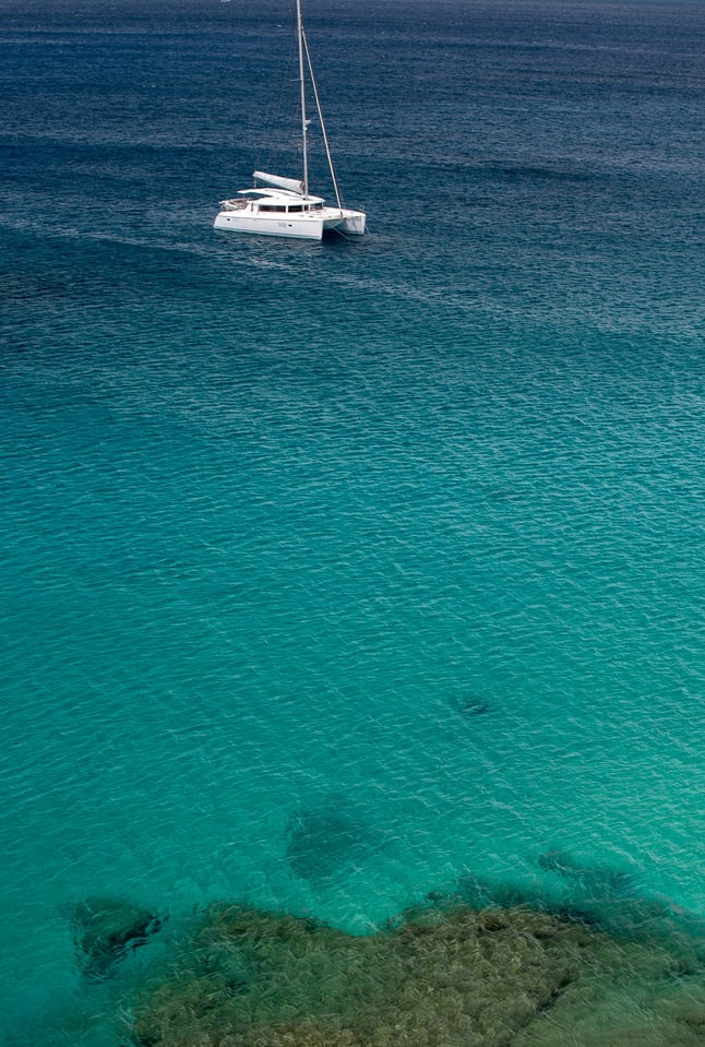
Immediately after landing in the port town of Playa Blanco, I headed east towards the famous chain of yellow sand beaches. The most famous of them is know as Playa de Papagayo. It is set in an idyllic setting – it is a small inlet in a rocky coastline with sine light yellow send. I was there in the early afternoon, with possibly the worst light.


Yet the photos look still pretty good due the dark tones of blue on turquoise colours of the sea water contrasting with the yellow sand. On the horizon, you can see the extinct volcanoes. From the top of the cliffs you can photograph also some details of the boats and snorkeling people.


Be aware that when accessing the beach by the gravel road, you will have to pay a daily fee of 3 EUR. The ticket is valid the whole calendar day, hence no problem to re-enter the location.

Salinas de Janubio
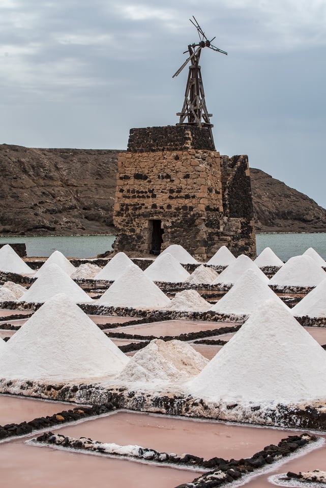
When going from the port city Playa Blanca in the direction of Timanfaya National Park, you will drive around a colourful salt lagoon called Salinas de Janubio. This salt production field has a shape of a semi-circle bay. On both sides of the bay, there is a parking lot. On the northern side, there are also some buildings around the viewpoint, including a restaurant.


But I recommend visiting the viewpoint on the other side (souther side). There is only a small parking place without any building. From here, you can photograph the whole laguna with volcanos of Timanfaya National Park in the background. When photographing from here, I recommend using longer focal lengths and focus on the colourful patches of saltpans.


From the parking place, there is an unofficial path going down some 50 altitude meters. I recommend going down and have a closer look (it takes 30 minutres going down and back). If you tread carefully, you can walk on the damns of the lagunas and take pictures of the pumps and salt piles in regular shapes. The shapes and colours give you plenty of possibilities for different compositions. If you really want some great pictures, wait for the sunset.


Mirador Los Hervideros
Just a few kilometres further north from Salinas, there is digression to the left leading to small parking place with a nice view over the dramatic lava sea cliffs. In the background, a few red-coloured volcanoes make this look like a scene from another planet. Again, this is an ideal location for sunset shot.

Laguna Verde, Playa del Golfo (Playa de los Clicos)
Further north from Salinas and Mirador Los Hervideros, you will reach a small village El Golfo. From here you can walk shortly on a visible and well marked trail towards one of the most fascinating beaches in Canary Islands with an incredible colour palette.


The black send beach has a big green lagoon which looks like from the Mordor. The cliffs around have reddish and ochre hues and together with the black lava sand on the beach, it creates a very attractive motif. Descending down to the laguna is forbidden. The access was possible from the south side, where there was another parking place.


Due to a recent land slide, this other parking place is now out of order and the access via this route is also forbidden. If you want to take a scenic shot from south to north with a huge rugged rock formation in the sea (ideal spot for sunset), you should wait for low tide and with suitable shoes and dry back, you can try to access the beach walking on the shore (you will have to climb some slippery cliffs). I have also seen some people climbing down to the beach from the upper viewpoint. In any case, be extremely careful.


Montana Colarada
This is one of the most photographed craters here in Lanzarote. Not only that it has a nice shape, but its southern side has a distinctive red colour. The colour is most pronounced shortly after a rain. There is a small parking lot and a path leading towards the souther slope of the crater. There you see a few big boulders that can be used as an element in the foreground. Best light here both in the morning and in the late evening. When I was there, the road leading towards this crater was closed for some unknown reason. Since only a half of the road was blocked and since I saw local people using the road, I went there and reached the parking place without any problems.

Vineyards of La Geria
On the way to the north, you will see several villages and little towns consisting of white houses. It is mandatory to build white houses only, which creates a very contrasting combination with the black lava landscape. In the vicinity of La Geria, which is the most important wine growing area not only in Lanzarote, but in the whole Canary Islands, you will see plenty of typical vineyards, consisting of small semi-circular stone walls protecting the plants from winds and erosion. The patterns of hundreds of those walls with the Timanfaya National Park volcanos in the background create a very attractive scenery.


Telamon Shipwreck
In the port of the biggest Lanzarote city of Arrecife, there is a stranded cargo ship (since 1981) which is a very popular motif for seascape photographers. If you want to have some spectacular light conditions, I recommend getting there early for the sunrise.


When photographing from the coast, be careful as the rocks are extremely slippery. I struggled to stabilize my tripod on the slimy rocks and almost fell down into the water while exposing.


Other Locations I Could Not Visit
Timanfaya National Park
During my trip, I did not have time to visit the National park. There was one reason beside my tight schedule why I skipped this one. In the national park, you are only allowed to move with the buses and hence you can photograph only from the bus (behind the windows). So even If I knew that the landscape is epic I prefer going on my own towards the other natural park Los Volcanes with craters and volcanoes, where you are free to use your car and walk freely.


Mirador del Rio
Almost at the very north, here you overlook the shore and the adjacent smaller island La Graciosa. The building at the mirador was built by the local famous architect César Manrique.

Teguise
Is allegedly the most beautiful town of Lanzarote with historical centre.


Conclusion
I believe Lanzarote is a very attractive location for landscape photographers. The colours – be it in the Salinas, craters or on the beaches, are quite extraordinary.
Next time I would reserve at least two days and plan properly to be in the many attractive spots located on the western shore of Lanzarote, especially at sunset. I would also pay more attention to the white buildings that are so typical for Lanzarote.
Have you been to Lanzarote? Please share your experience in the comments section of this article.
Table of Contents