Photo Spot Summary
Country: United Kingdom
Category: Landscape
City: Achnasheen
GPS Latitude: 57.533974
GPS Longitude: -5.515490
Directions
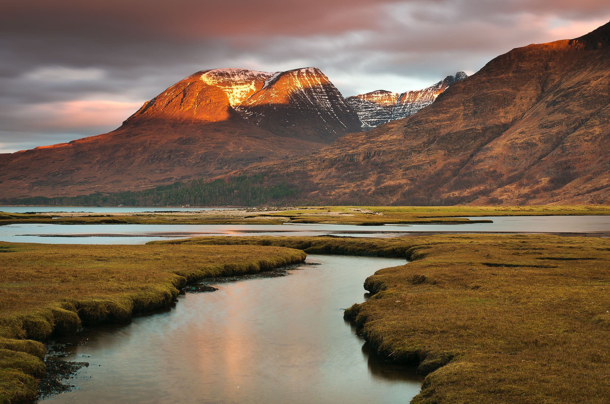
Find this view in Upper Loch Torridon. The salt marshes lie across from the village of Annat, which nestles under the eastern slopes of the Liathach peaks.
Photo Spot Details
On the right day, the sunrise strikes the slanted bowl that is the peak of Beinn Alligin. The first sunlight of the day makes the slopes burn a reddish/pinkish hue. The photograph was taken in an unnaturally mild February; usually at that time of year there would be a dusting of snow and the effect would be quite different. The area is immensely rich in other photographic possibilities (Loch Clair and Loch Maree, for instance).
0 Comments
Newest