My wife, Tanya, and I recently vacationed in the Canmore/Banff area of Alberta, Canada. We settled on this location after reading a variety of reviews and looking over some stunning photos of the many attractions and wildlife. We planned a series of activities that would take us to some of the most scenic, historical, and cultural locations, provide some challenging hiking expeditions, and enable us to take a “few” photographs along the way. After receiving a new Nikon D800 (review), which I tested thoroughly, I was eager to put it to work in the field. Most of the photos in this article were taken with the D800, although some were shot with my infrared D90 (converted by Lifepixel.com). For those of you reading this on an RSS feed, you may want to consider linking to the main Mansurovs site, as there are quite a few photos associated with this post.
Table of Contents
From Calgary To Canmore
We flew into the Calgary airport, and after renting a car, began the 74 mile drive from the Calgary Airport to the town of Canmore. This trip is an interesting study in transitions. Near Calgary, everything seems to be under construction. Bulldozers, heavy earth movers, building cranes, and construction signs dot the landscape in every direction. The terrain is pretty flat apart from a gentle mountainside slope on the western side of the city. Off in the distance, we could see some purplish mountains but didn’t have a good sense of their scale. 25 miles or so outside of Calgary, the scenery changes quite a bit. Green rolling hillsides of farm land become the dominant theme, with the familiar golden yellow hay bales lining the bright green fields. The purplish mountains have risen in stature quite a bit and we quickly realize that they are far different than those we left behind in western Pennsylvania. We also unfortunately discover that there are few exits for gas or food!
At the 50 mile mark, the landscape is changing quite a bit. Those little purple mountains seem to grow larger by the minute. Green fir trees that seem to have been cloned, now begin to populate the landscape like huge blades of grass. At the 60 mile mark, we are at the base of the mountains. The term “majestic” doesn’t quite rise to the occasion in describing what we now see. The mountain peaks require you to edge closer to the car window and strain your neck in order to see them. Even in August, we can identify snow patches that never completely melt.
The road begins to roll gently as we wind toward the valley between the mountain peaks. The number of signs warning you about the local wildlife population increase, and based on the fences that line the woods along the road, we suspect that the signs are not to be taken lightly. We had taken 3 exits hoping to find a restaurant or gas station only to conclude that the notion of modern facilities next within 25 miles of the exit is a mirage. We begin to imagine that grizzly bears and wolves have posted these exit signs to lure gullible travelers, low on gas and food, off the main highway where the animals can leisurely dine on them.
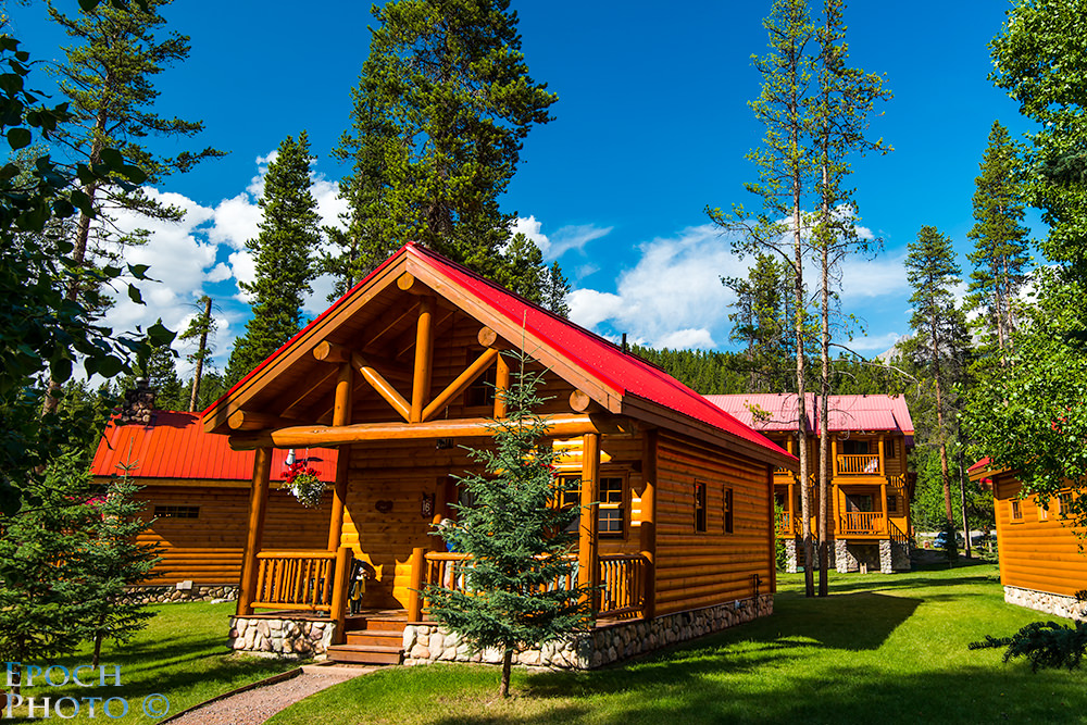
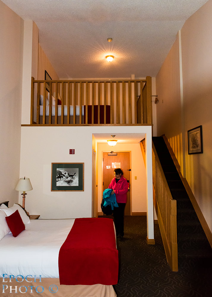
Within 5 miles of Canmore, we are deep into the mountains that seem be growing larger before our eyes. I am constantly trying to keep my eyes on the road as the rocky towers on both sides of the road continue to command my attention. By now, we are seriously wondering if we have been transported to another planet, since it couldn’t possibly be part of the one which we came from. Soon we arrived at the Falcon Crest Lodge, which proved to be the excellent “base camp” for our adventures.

The lodge was a mere 10 minute drive from the entrance of Banff National Park and less than 5 minutes from downtown Canmore. The spacious, clean, comfortable condo, with kitchen, living room, balcony, grill, indoor/outdoor parking, and washer/dryer was more than adequate for our needs. With the airlines charging a penalty fee for bags in excess of 50lbs, the ability to regularly wash/dry our clothes in our room was a big plus, as it enabled us to easily keep our bags under the limit. The Falcon Crest staff was incredibly courteous and helpful throughout our stay.

Tanya and I selected Canmore since it seemed a bit less crowded and commercialized than Banff. Banff is a very historic and scenic town, with plenty to do and see. In the peak summer months, however, it can become quite congested with respect to both cars and people. Canmore had much more reasonable hotel rates and less sell-out situations than we found when investigating Banff. You can’t go wrong with either town, however, as it is more a matter of your priorities.
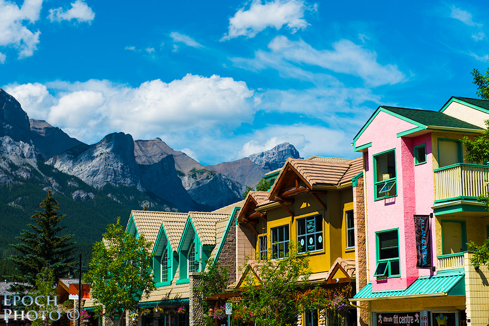
Once we had some time to explore the area, we were certain that Canmore was indeed a better fit for our needs and we had made the right decision. The town of Canmore is relatively small, with the main street having the lion’s share of businesses and restaurants. It is well known for its role in the 1988 Winter Olympics and hosting such movies as, “Legends Of The Fall,” “Shanghai Noon,” and “Brokeback Mountain.”
You can walk the entire length of Canmore’s Main Street in less than 10 minutes. The town has a very homey, rustic feel to it. The colorful buildings and shops draw a sharp contrast to the huge mountains in the background. Canmore is popular with tourists, but doesn’t experience the same level of congestion often encountered in Banff during summer months.
Grassi Lakes
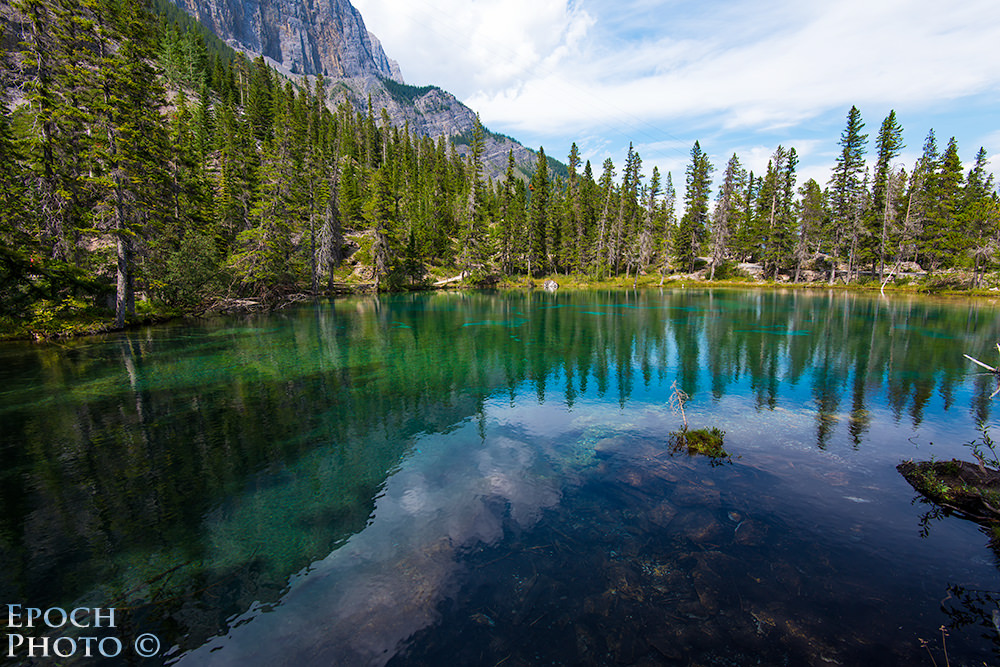
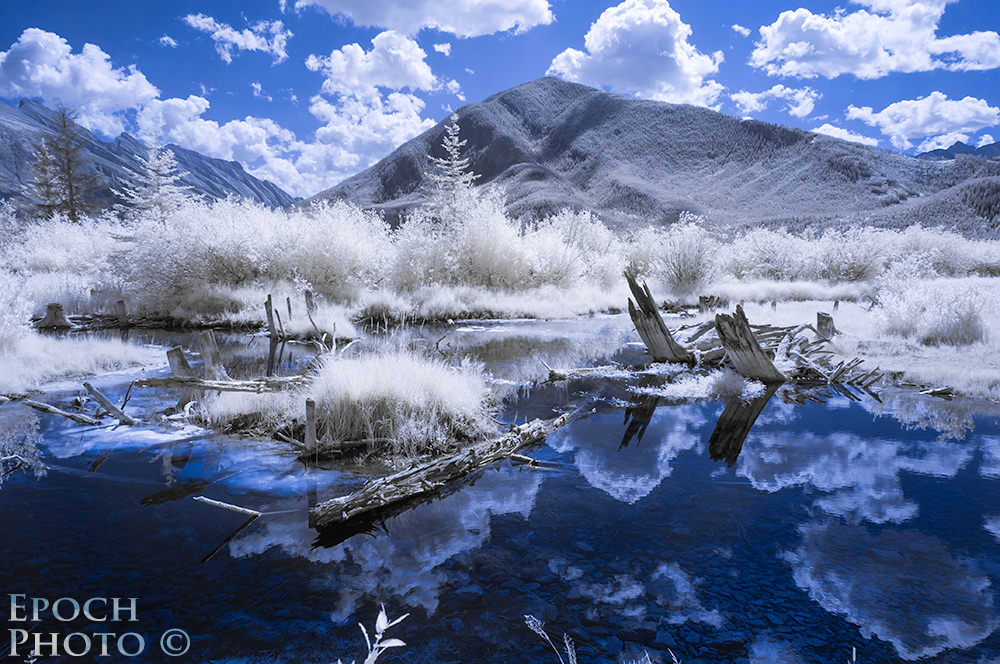
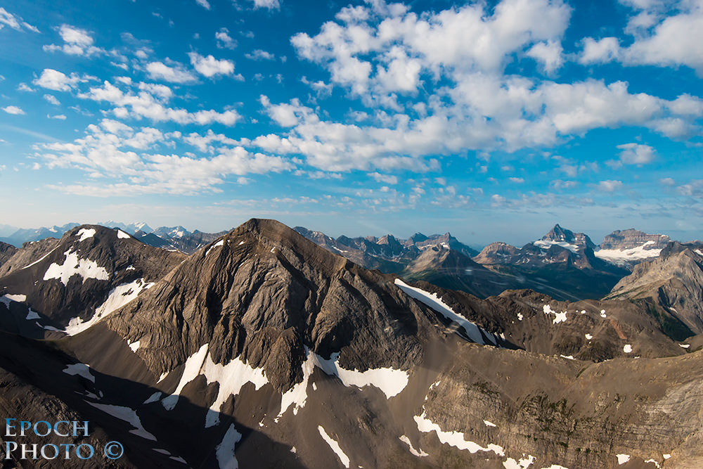
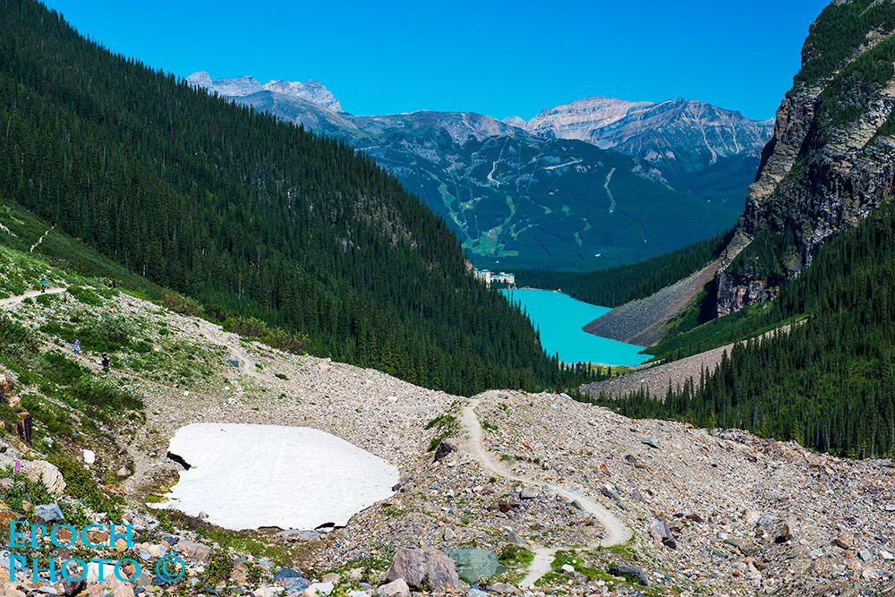
Grassi Lakes are located a few miles outside of downtown Canmore on highway 742. This area provides a number of hiking trails ranging from very easy to extremely difficult. We of course chose the difficult hike. The beginning part of the hike was relatively easy, but increased in difficulty with the rapid rise in elevation. Along the steep trails, we were treated to many stunning views of the valley, waterfalls, and surrounding mountains. It took us a little more than an hour to make the ascent to a series of beautiful blue-green streams and lakes. I had often thought that photos of bodies of water such as Grassi Lakes had to be enhanced in some way to reflect a bright blue-green color that didn’t exist.
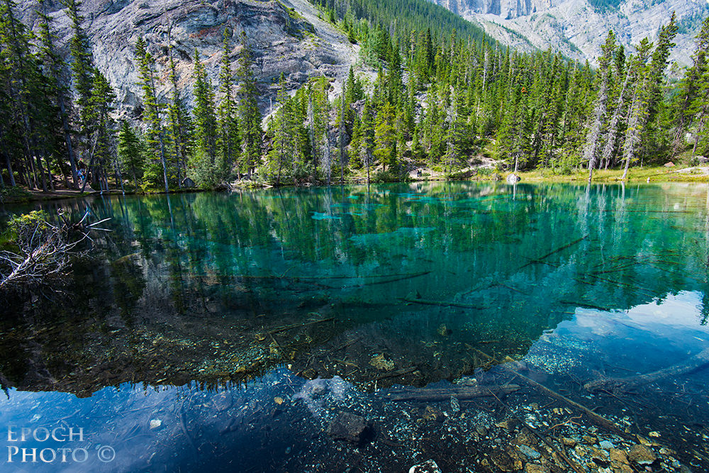
And yet, Grassi Lakes, and every other body of water that fed from glaciers, shared a similar blue-green color. This color is apparently the result of “rock flour,” which consists of very small particles that have been deposited by the mechanical grinding that the glaciers exert on the rocks below. These particles absorb most of the colors associated with visible light, but reflect those at the lower end of the spectrum – blue and green.
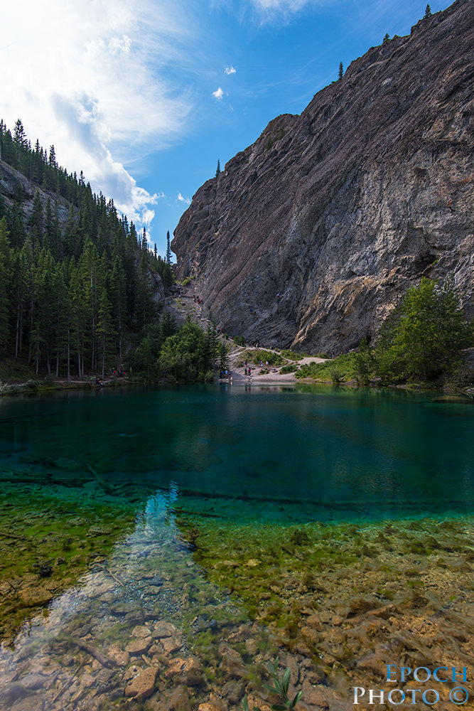
Depending on the size and composition of the rock flour, the color of the water will vary from a shade of bright blue to a greenish turquoise. Some bodies of water appear to have a milk-like consistency, while others are crystal clear. Bordering Grassi Lakes is a nearly vertical mountain wall which attracts rock climbers from around the globe.
Brian Merry – Local Photographer And Guide
It is very beneficial to have someone that can provide some photography pointers in an area as expansive and diverse as Banff and Canmore. You can sometimes find a group photography tour that overlaps with your trip and matches your specific interests. Such tours range from easy hikes, targeted toward more casual photographers, to very focused and disciplined trips for professionals and serious amateurs that begin an hour or two before sunrise. Some tours can also extend into the 1:00 to 4:00 AM range if the goal is to take photographs of the night skies. We were unable to find a photography tour that met our interests, so we reached out to some area photographers regarding the potential of a private tour. We found Brian Merry, a local professional. Brian is a member of a group that includes approximately 40 professional Banff area photographers who both collaborate and compete across a variety of photographic specialties.
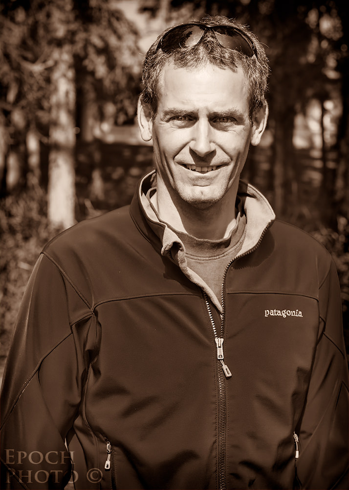
After exchanging a few emails with Brian regarding his background and our interests, I called him to discuss our upcoming trip. Brian was very friendly and had a number of ideas regarding how we might allocate our time. We agreed on a fee for a half-day tour of the area. I had considered relying on a photography ebook from the well-known and talented Canadian photographer, Darwin Wiggett. Darwin’s well-written 93 page book, illustrated with some stunning photos, is extremely comprehensive, even listing specific times of the day to be at specific locations throughout the year, and detailing the camera settings used to take each photo. I highly recommend Darwin’s book for anyone visiting the area, but believe that the book is far more helpful if you first gain some familiarity with the area.
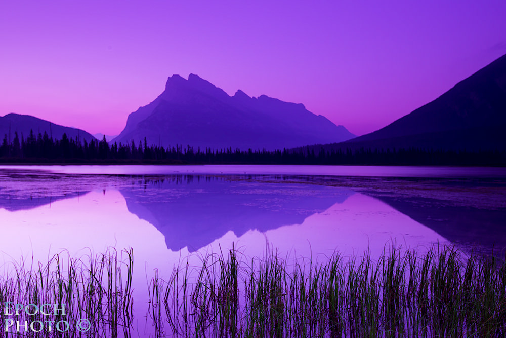
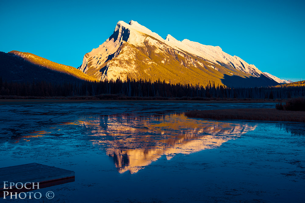
Tanya and I met Brian at 5:45 AM one morning and quickly navigated to a local lake to capture some sunrise shots. Although the sunrise didn’t produce the stunning array of red and gold colors from the previous day, we did get some very good landscape pictures. We came back to this site a number of times at different parts of the day throughout the week to capture the different lighting conditions with both with my D800 and infrared D90.
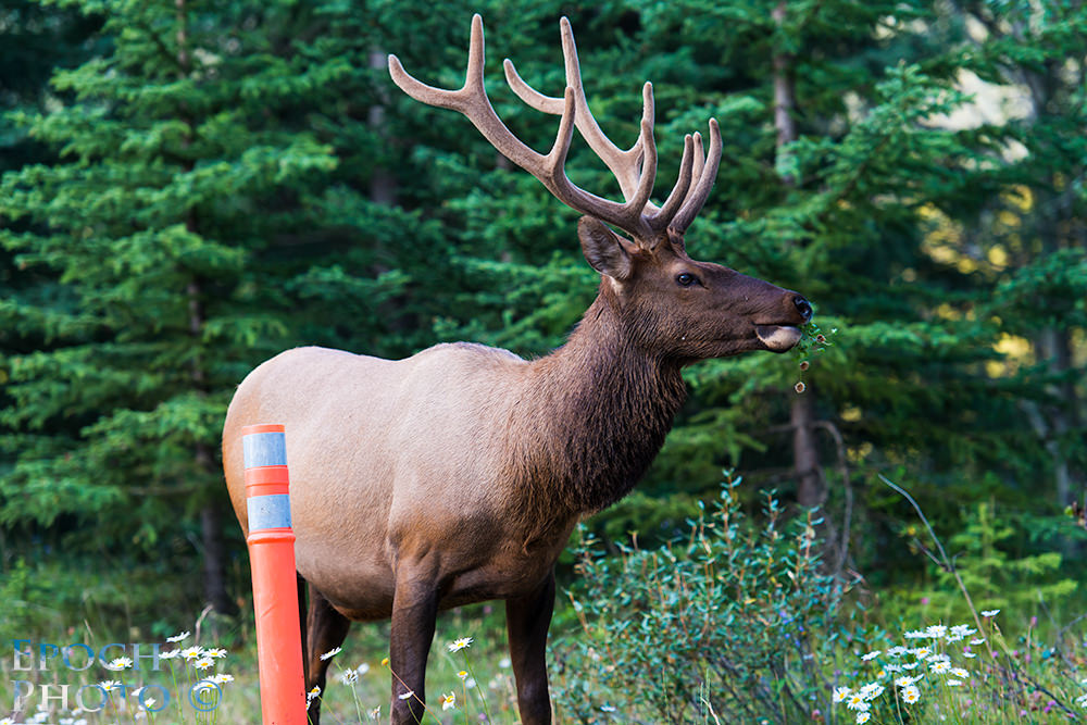
Brian then drove us to the Bow Valley Parkway, where bear, wolves, and elk are often seen. We made our way to these sites and came across two huge bull elk, seemingly unconcerned about us being a mere 25-40 feet away. Elk can range upwards of 1,200 lbs and sport massive racks during the summer, fall, and winter months. People should always exercise caution around any wild animal, particularly during the rut or mating season, when the animals can be quite aggressive and moody. As I was writing this article, I read the tragic account of the first hiker to be killed by a grizzly in Alaska’s Denali Park. Apparently, the hiker was taking photographs for some time of the grizzly when the bear’s mood changed.


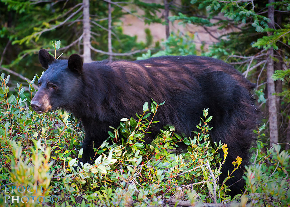
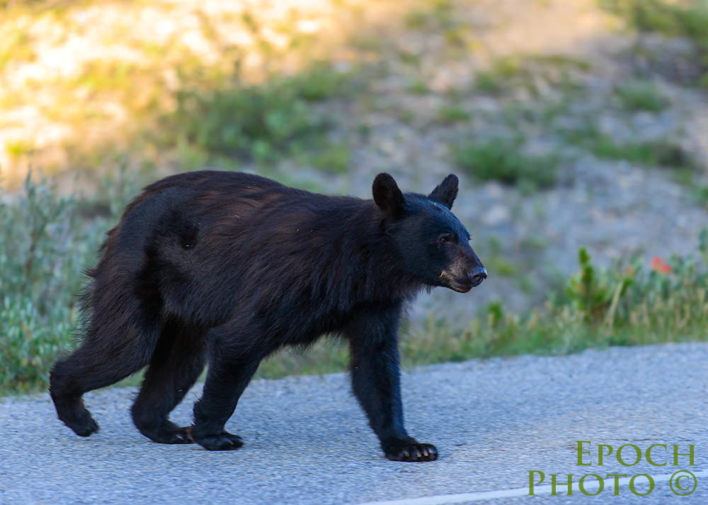
Despite scouring the other hot wildlife locations, however, we were unable to connect with any bears or wolves that morning. Such is the way of wildlife photography – the animals don’t always show up on queue simply because you brought your long lenses! It certainly wasn’t for lack of trying, however, and we decided to return to the area within the next few days. On our second time through the Bow Valley Parkway, we did find a black bear feeding on buffalo berries.
We also stopped at the Baker Creek Chalets and Bistro, a colorful suite of log cabins just a few miles from Lake Louise. Baker Creek’s Bistro is well-known for its excellent food. It also publishes daily wildlife sightings for avid nature photographers. If you are traveling to the area, consider staying or visiting Baker Creek.
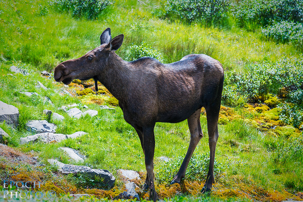
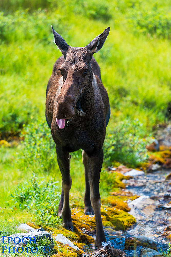
Brian provided us with quite a few tips regarding our stay and some excellent suggestions for other specific places to visit for both landscapes and wildlife photography opportunities. These suggestions resulted in our finding moose, bear, and big horn sheep in the locations that he had recommended. If you are considering a trip to the Banff/Canmore area, I recommend contacting Brian.
Alpine Helicopter Tours
After investigating a variety of helicopter tours, we determined that Alpine Helicopter, Ltd. would be a good choice based on its reputation, reviews, and tour options. We chose the ½ hour “Mount Assiniboine Tour.” Based on the photos we had seen, it promised to be quite an adventure. Despite having worked on my private pilot’s license and flown a variety of airplanes, I had never ridden in a helicopter. We came by the helipad the day before to get a sense of the area and take a few pictures of the helicopters in the glow of the late afternoon sun.
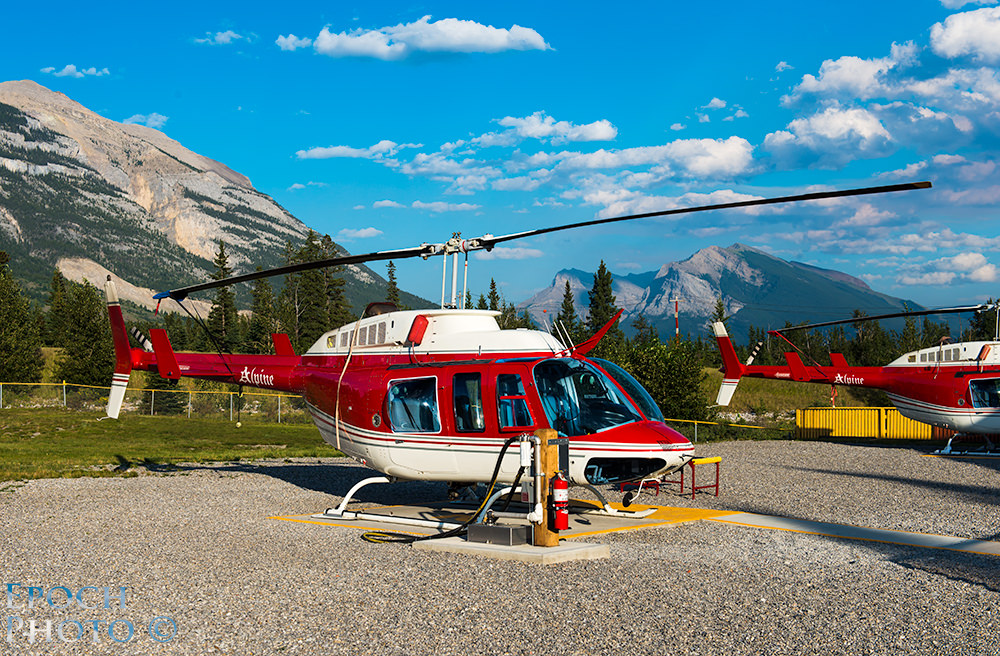
The next morning, we arrived a bit early to see some of the earlier adventurers taking off and landing. Alpine Tours runs a very professional, organized, and disciplined operation. With the number of passengers they are responsible for, they have to. If you stay at Falcon Crest Lodge, you will have a very short trip to the Alpine helipad, since it is only a few hundred yards down the street.
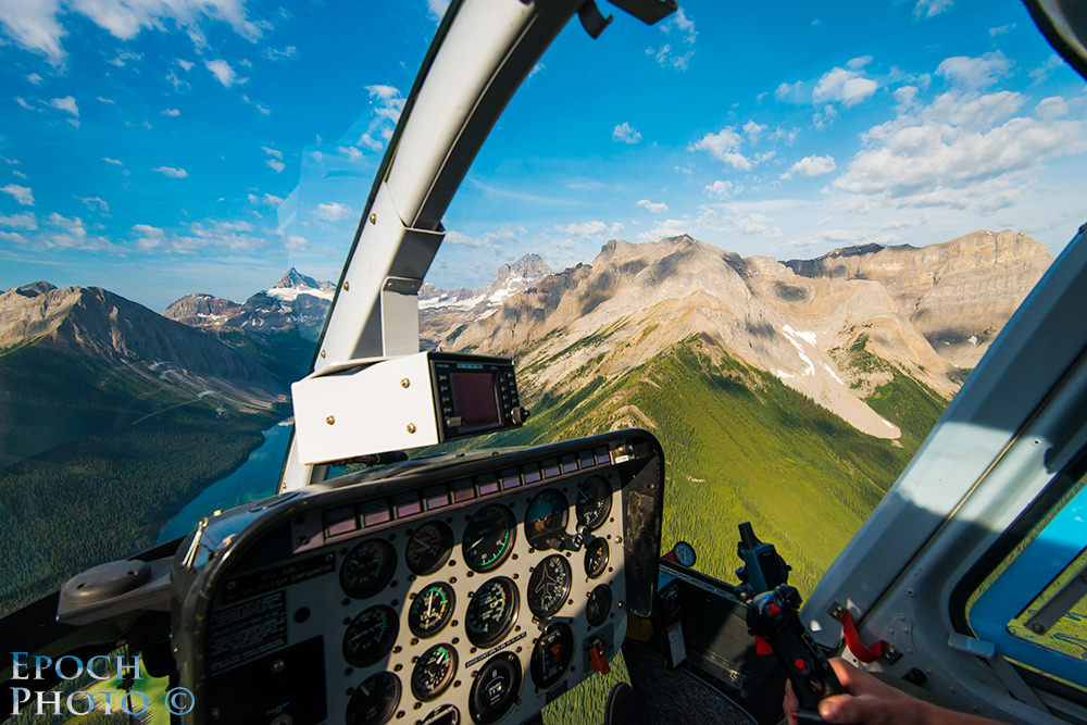
After a brief introduction to our pilot, Logan, we quickly took off begin our climb into the mountains. Logan provided some very interesting insights regarding the mountain ranges, history, and I don’t recall saying much in response, however, as I suspect we were simply in awe of the fantastic view. I realized very quickly that despite the superb resolution and dynamic range of the Nikon D800 and quality of Nikon’s best lenses, the associated photos don’t truly convey the sense of the beauty we experienced. While it was a bit tricky to completely eliminate the glare produced by the helicopter window, it detracted little from the overall ability to capture images from these amazing heights and angles.
Despite having flown Cessna 152s, 172s, 182s, and some Pipers, I found that cruising toward the nearly vertical face of some of the highest mountain peaks and then quickly rising above them was quite a bit different than flying in an airplane!
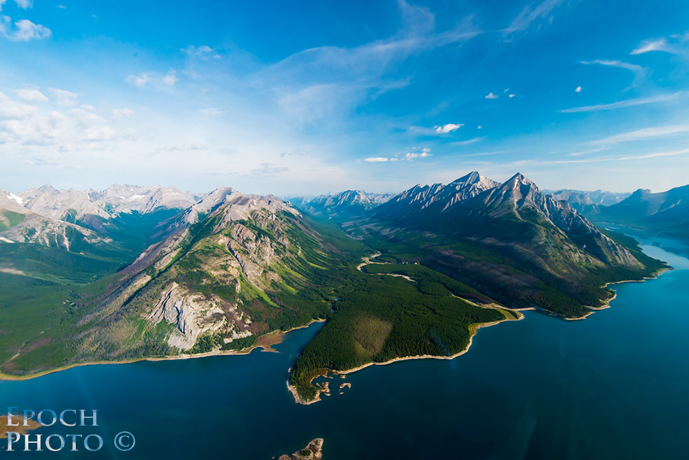
The Alpine Helicopter tour through the Canadian Rockies should be on everyone’s “must do” list.
Kananaskis Country
Brian had used the phrase “dirt road” in discussing a portion of the loop around the Kananaskis Country Loop (Highway 742 to Highway 40 to Route 1), which included Bow Valley Wildland Provincial Park, Spray Valley Provincial Park, Peter Lougheed Provincial Park , and Kananaskis Village. I thought he was describing a mile or so of the road that might have been under construction. Even after stopping at the Canmore Information Center to get an update on road conditions, and hearing the same term used, I was still under the impression that the dirt road portion of the journey was but a mile or so. Apparently I wasn’t paying close enough attention to description of the road that Brian and the woman from the Information Center shared. Little did I realize “how much” of a dirt road we were about to experience…
As we traveled past Grassi Lakes, we encountered the dirt road, which was actually gravel and slightly larger rocks. It was like a scene out of Mad Maxx – with some cars driving faster than I would have thought warranted given the conditions and dust flying everywhere. As cars came barreling by us, we often had to stop, since we were nearly blinded by the ensuring dust storm. We came along a woman biking. We imagined that after a few miles, she probably would have qualified for “Brown or Gray Lung” and whether the cardio vascular benefits of the steep bike climb outweighed all that dust that must have accumulated in her lungs along her ride.
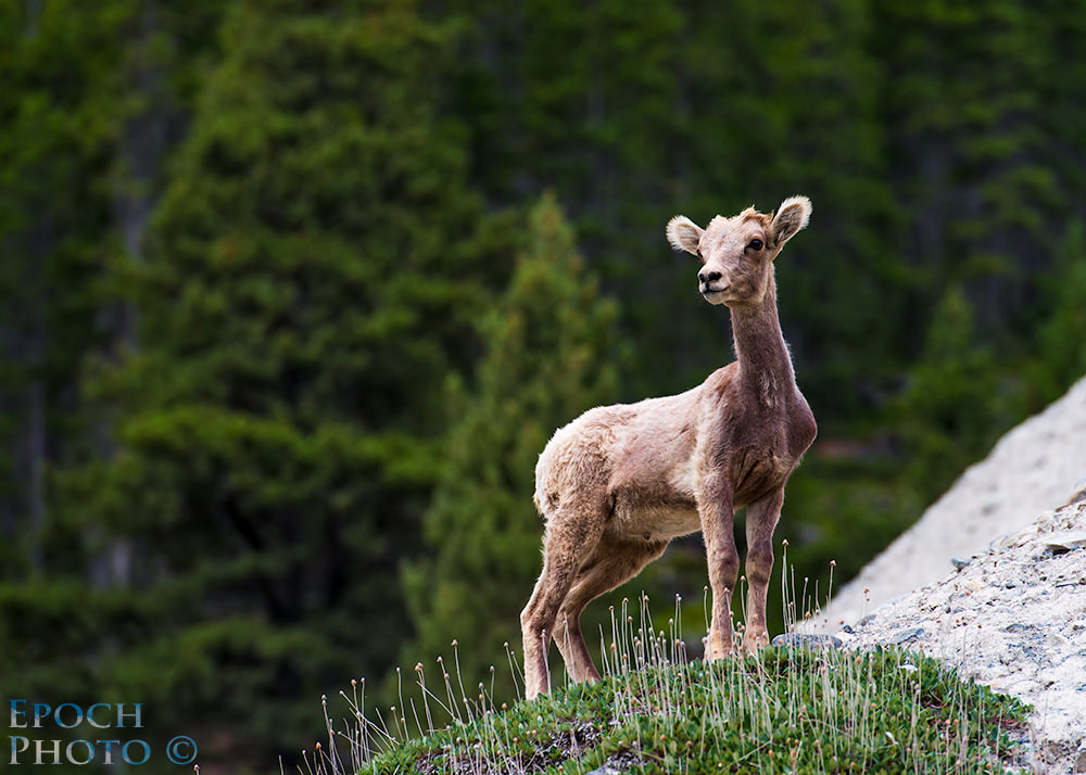
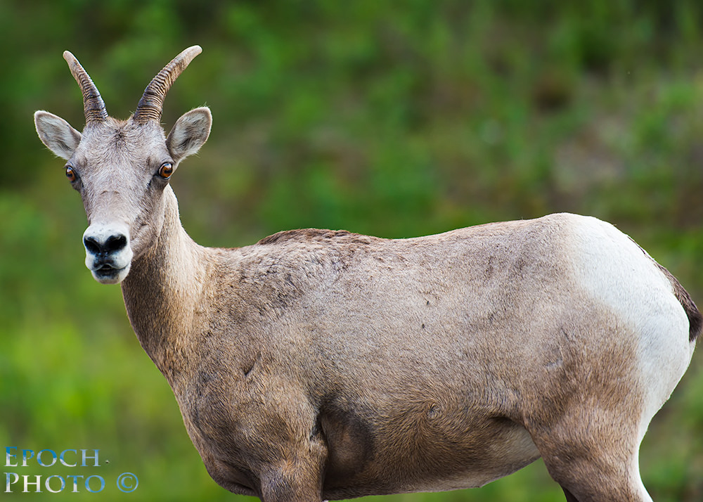
Within a mile or so into our dusty adventure, a driver headed in the opposite direction stopped to inform us that some big horn sheep were walking along the road and urge us to exercise some caution. We soon came upon a pair of adult sheep and their two kids. One of the kids seemed a bit skittish and quickly bounded up upon a steep rocky hillside and appeared to be posing for my 70-200mm VRII. The other 3 sheep didn’t seem to be bothered in the least by our presence.
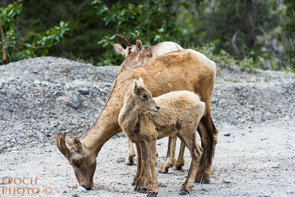
I got within 20 feet or so of the trio who were all too content to lap up some grain that must have fallen from a truck. While I crept up to within 25 feet or so of the trio, the other kid continued to maintain a rather stoic stature upon the hill.
As we were to find out from the gentleman that operates a huge grader, the dirt and gravel road ran the entire length of Highway 742 – 38 miles! So much for a temporary stretch of rocks and dust… We soon forgot about the dust storms, however, when, after miles of dawdling along at 25-35 km/hr (speed limit was an unimaginable 80 km/hr), we came across a baby bear cub and what we believed was a year old bear cub that never left its mother.
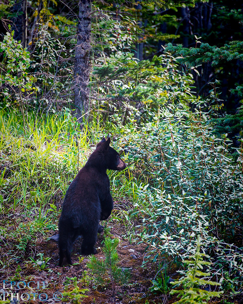
While we never saw momma bear, we were able to capture a few shots of baby bear standing on her hind legs, before she bounded off to join her older sibling in the woods.
As we were turning into the entrance of Mount Engadine Lodge, we were fortunate to come across a female moose, who was grazing on the delicate grasses along the roadside and quenching her thirst in the local stream. Like the sheep, she didn’t seem to care that we were close by snapping photos of her.
Mount Engadine Lodge is pretty secluded and the only commercial establishment we came across as we made our way from Canmore to Highway 40. We stopped by for lunch and were warmly greeted by Shari-Lynn and Chris, who were just setting up what they refer to as the “afternoon tea.” This charming couple clearly found their calling combining their warm personalities, love of nature, and generous hospitality with a rustic, inviting lodge, bordering an expansive marsh that regularly attracts moose and other wildlife.
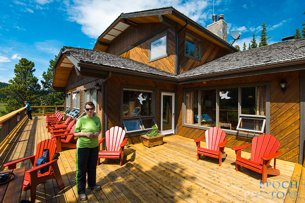
From the deck of the lodge, you can have a cup of coffee or tea while watching a group of moose grazing in the appropriately named “Moose Meadows.”
Hikers and other nature lovers can’t help but feel in their element while staying at the Mount Engadine Lodge. During our 2 ½ hours at Mount Engadine Lodge, we made the acquaintance of an Alaskan photographer and hiker who had traveled the world, and had many interesting stories to share. Despite her many fascinating journeys, she too was in awe of the scenery of the Canadian Rockies. And if you don’t happen to see a moose, you can always bring your own! :)

We greeted the paved Highway 40 with a sense of relief, as we were beginning to wonder how long our Ford Taurus’ low profile tires were going to last on the rocky terrain, and how many days we might have to wait before AAA arrived if we blew a tire! Our navy blue car had transformed into an unhealthy looking shade of beige, and every time we opened a car door, we seemed to coat the inside of the car with a new layer of dust.
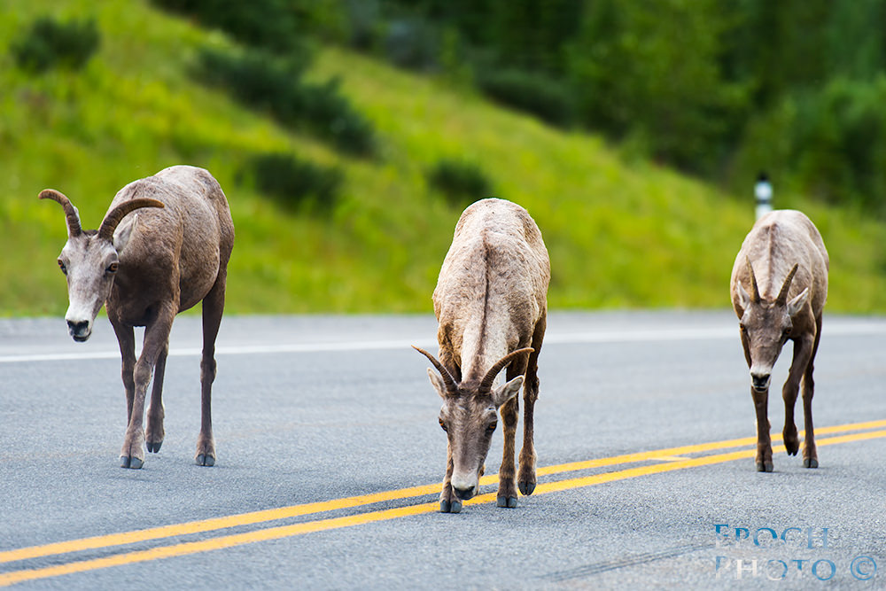
Not long after turning onto Highway 40, we encountered a family of sheep which seemed to believe that the highway belonged to them and we were trespassing. They stopped traffic in both directions and didn’t seem to be bothered one bit by the cars backing up in front of and behind them.
From Canmore To The Columbia Ice Fields
Our next adventure took us 120 miles from Canmore to Columbia Icefields Center, at the base of Mount Athabasca Glacier. 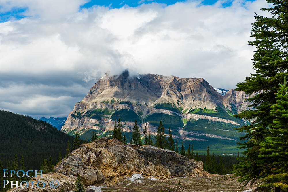
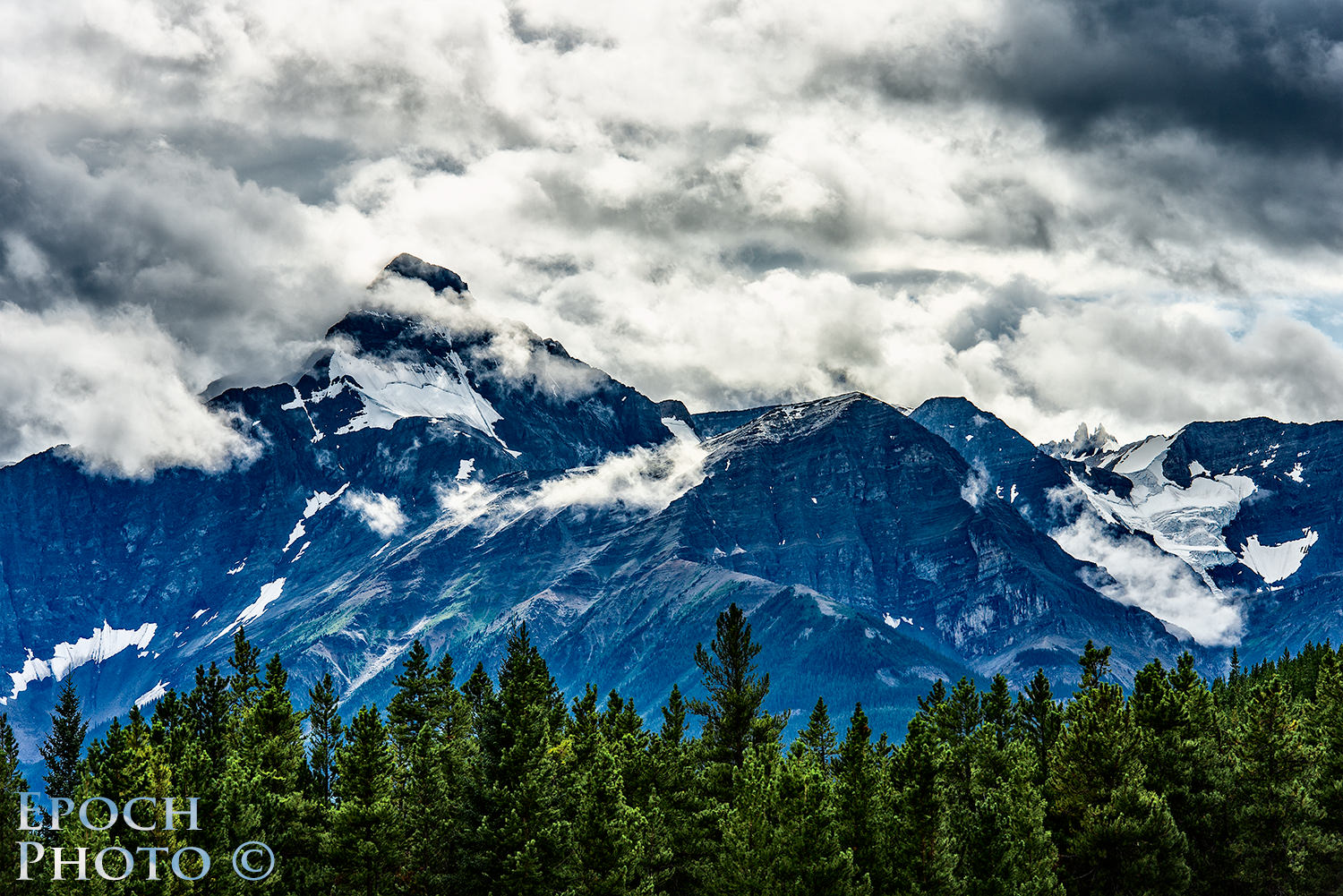
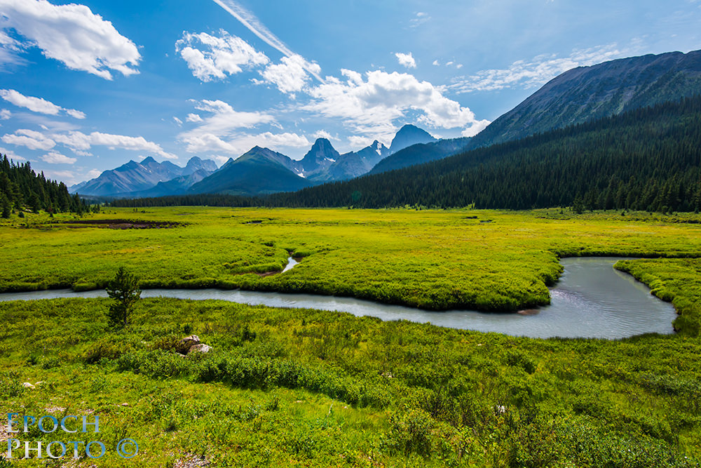
With each turn of the road, we viewed one outstanding spectacle of mountains, trees, streams, and lakes after another along our journey. We stopped quite a bit along the way, each time thinking we had seen the “best of the best” of the dazzling display of rocky, colorful landscape scenes. Each time, however, we were wrong. We easily doubled our estimated travel time with our frequent photography detours. 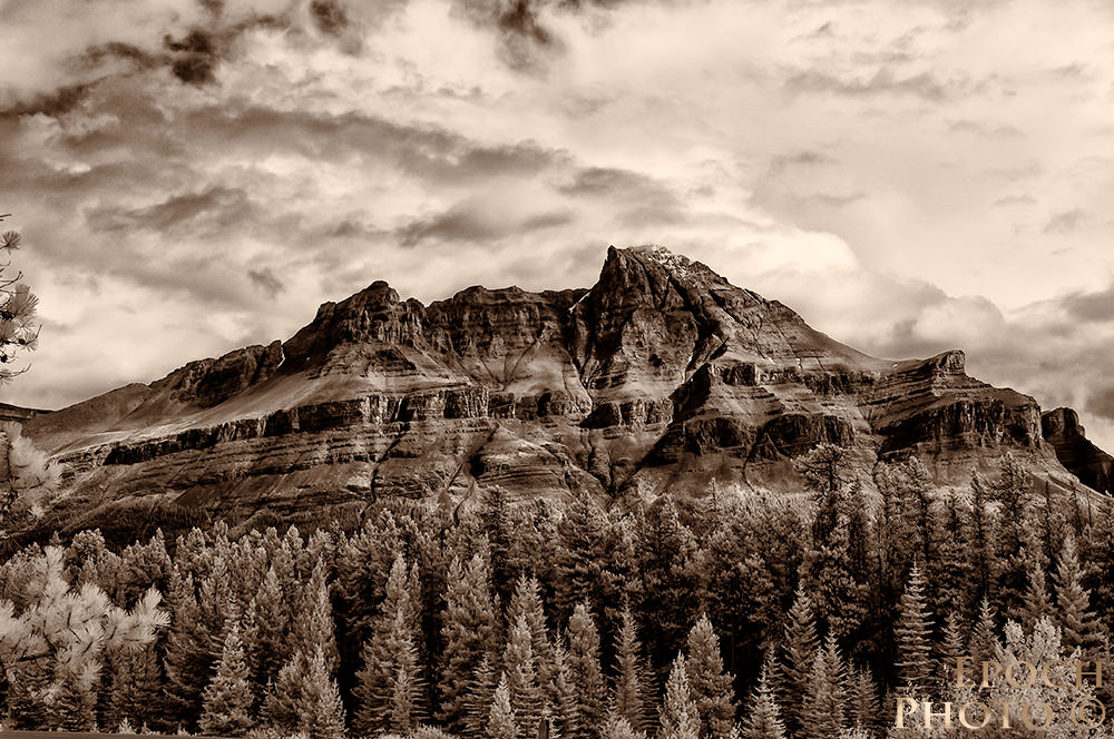 With each stop, it seemed that our car and cameras attracted a few other cars, particularly if it was near a wooded area, since people assumed we were stopping to capture photos of bear, elk, moose, or other wildlife.

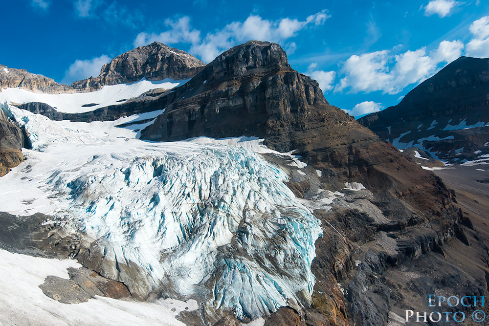
Columbia Ice Fields
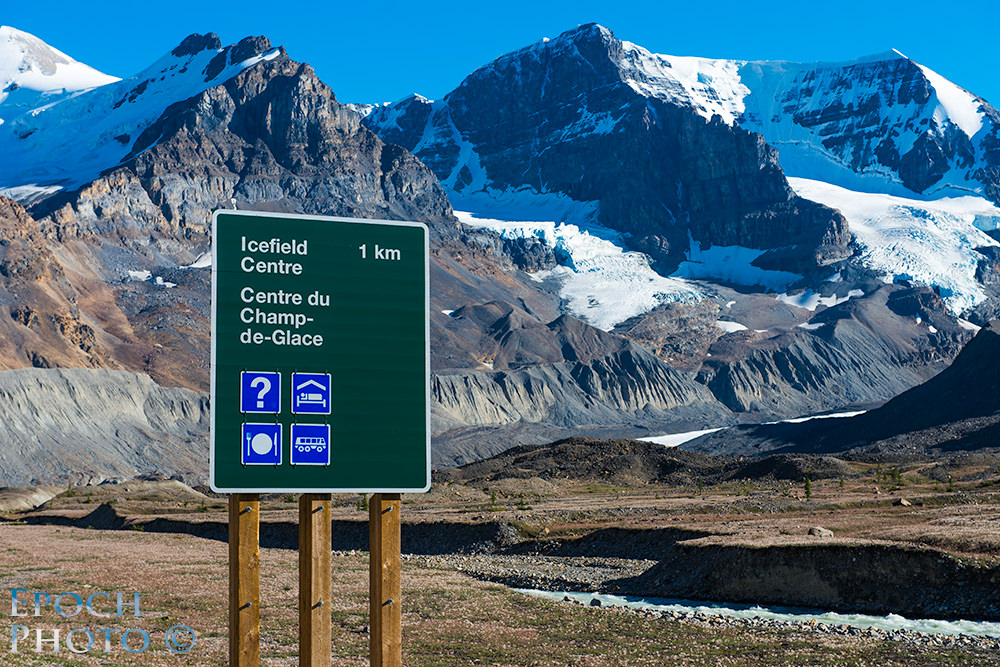
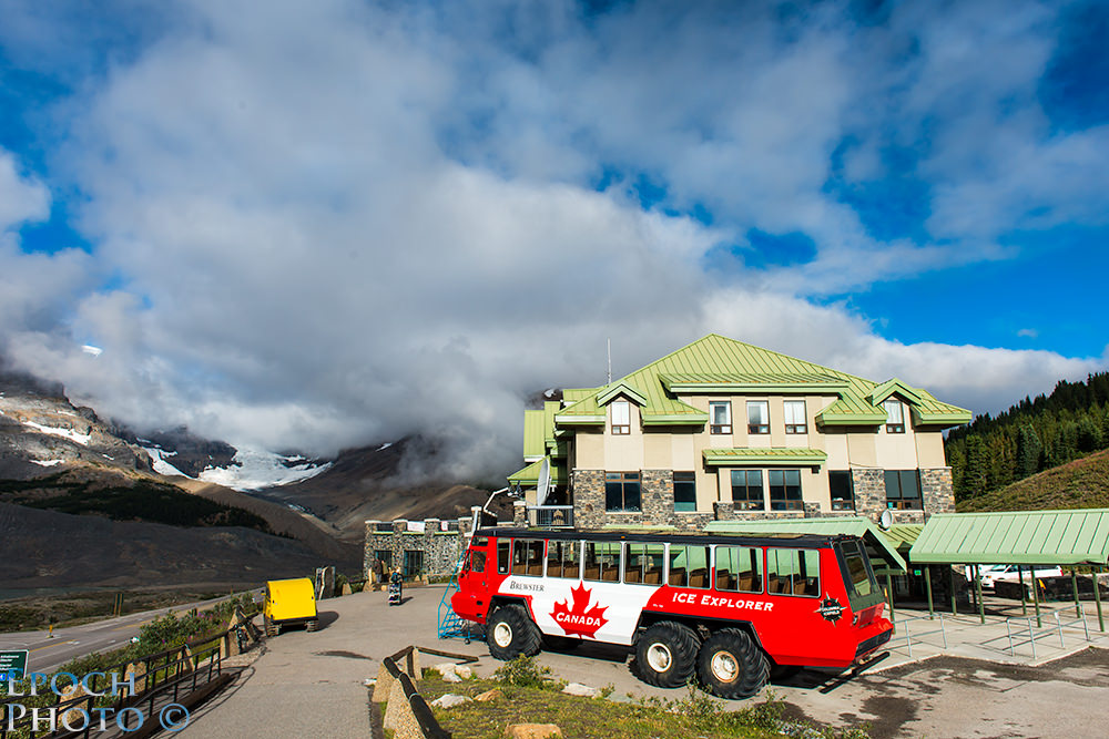
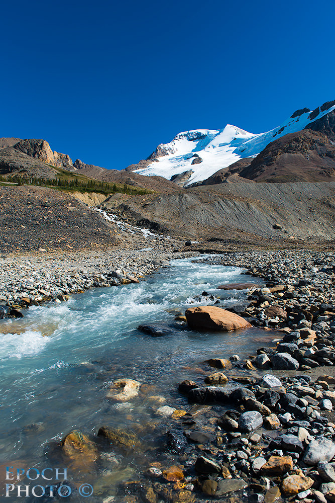
The Columbia Icefields refer to the snow-covered mountainous region that feeds 8 glaciers at the southern-most tip of Jasper National Park. We booked a room at the Columbia Visitor Center so we could get an early start on our 2 hour hiking tour of the ice fields the next morning and follow-on trip to the Athabasca Glacier.
We enjoyed a delicious dinner while watching the clouds descend from the peaks of the mountains to the roadway. We experienced a strange phenomenon when viewing the glacier. Without looking at anything that might provide clues regarding its scale, the glacier didn’t appear to be much more than a few hundred yards away. But when we noticed a huge bus-sized Ice Explorer, which appeared to be the size of an ant, crossing the glacier, we quickly realized just how massive the glacier was and how mistaken we were relative to judging distances and the scale of the objects we were viewing. We would continue to make such mistakes, which made us realize how those, hiking in extreme conditions, might easily experience the same errors in judgment and suffer far more serious consequences.

The Visitor Center of the Columbia Icefields serves many purposes: information center, restaurant, store and gift shop, and booking center for various tours. And good thing it does, as there is nothing within 35 miles or so in either direction. 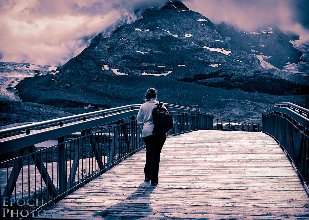
By “nothing,” – I mean nothing – no gas, no internet, no cell phone coverage, no streetlights, no restaurants (apart from the two at the Visitor Center). There was a fee-based internet access service, but I was told that it was pretty slow and not worth the effort. When I dialed the hotel’s front desk to determine which radio station I could use for our alarm clock wake-up call, I heard, “We don’t get any radio stations in this area” in response!

The next morning, we took our Glacier tour with a very interesting Ice Explorer driver, named “Sammy.” Sammy explained that he had been an accountant by trade in his native Japan, but decided to take up Ice Explorer driving for something different. Sammy’s humorous repertoire had our bus laughing during the ride to and from the Athabasca Glacier. If Sammy ever decides to quit driving Ice Explorers, he should look into hosting his own comedy show in Las Vegas! ;)

The Ice Explorers are quite an interesting combination of technology, costing approximately $500,000 apiece. They certainly are capable of doing their jobs, easily navigating some incredibly challenging terrain and making it seem pretty easy.
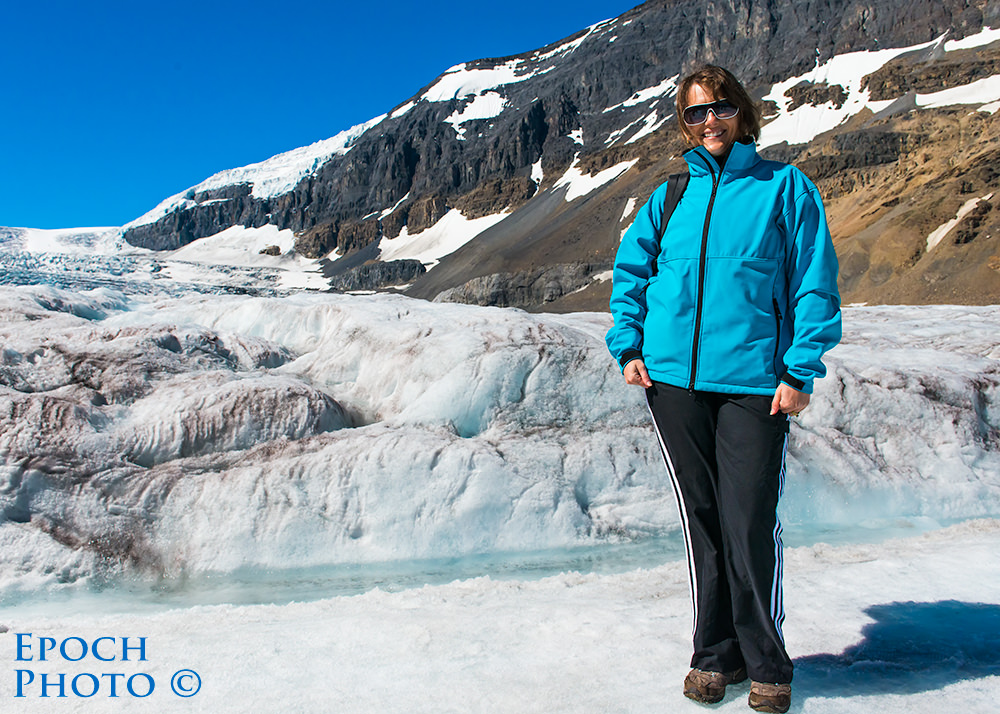
Our next tour was a hike starting from the small lake in front of the Visitor Center, which supplies all the water needs for the area, and led to a portion of the glacier wall at the far end of the rocky landscape. Antoine, our guide, proved to be a veritable encyclopedia of information regarding weather, geology, history, and nature. He clearly knew his stuff and had a way of engaging his audience, even the 6 and 8 year olds that were part of our group. Antoine was able to make a walk through a pile of rocks, ice, running water, and a few sparse shrubs and plants as interesting as a good spy novel.

When I joked aloud that it appeared that we had landed on Mars, little did I know that, as Antoine would soon share, the robots that recently landed on Mars were indeed tested and refined on the rocky ground we walked upon. This made good sense, since the rocky terrain of the Athabasca Glacier was probably as close to the conditions on Mars, relative to geography and temperature, as one could imagine.
On our journey back to Canmore, we were fortunate to encounter a black bear feeding on buffalo berries, which are small red berries and a very popular food source for the bear population. We were informed that an adult bear could easily consume 200,000 buffalo berries in a given day. This black bear attracted quite a crowd.
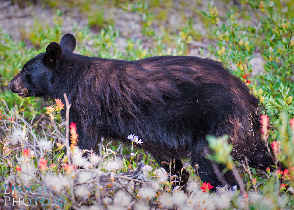
It is common for most people in the Rockies to pull over whenever they see someone else stopped and taking pictures. The bear had approximately 12 cars worth of admirers lined up at the peak of his evening dinner activities. At one point, he crossed the road within 5 feet of our car, and continued feeding a mere 15-20 feet away.
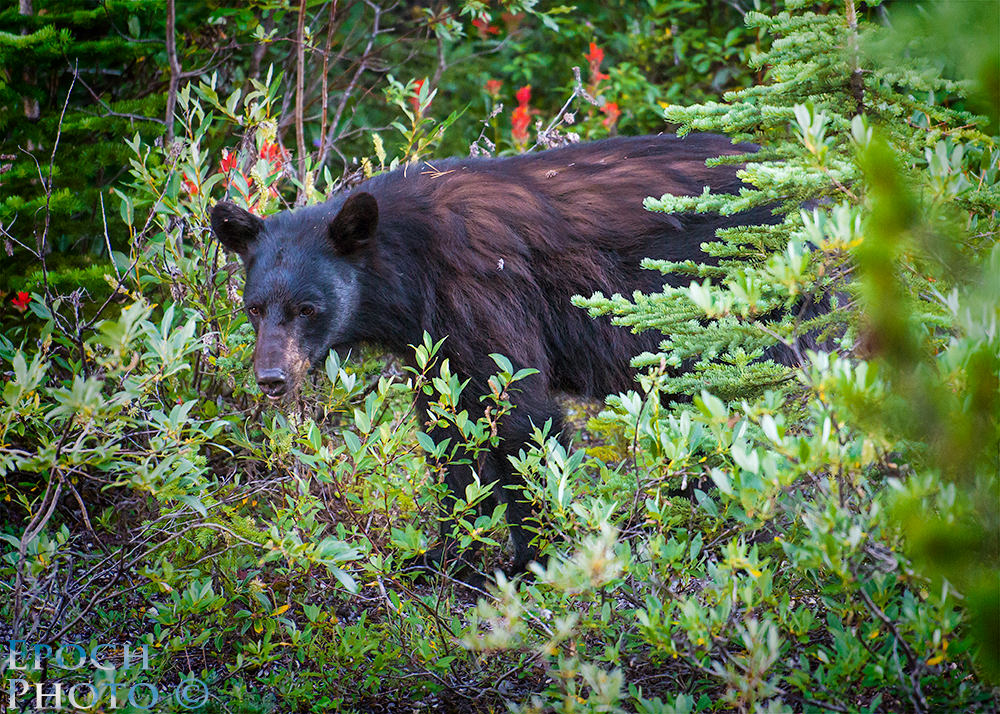
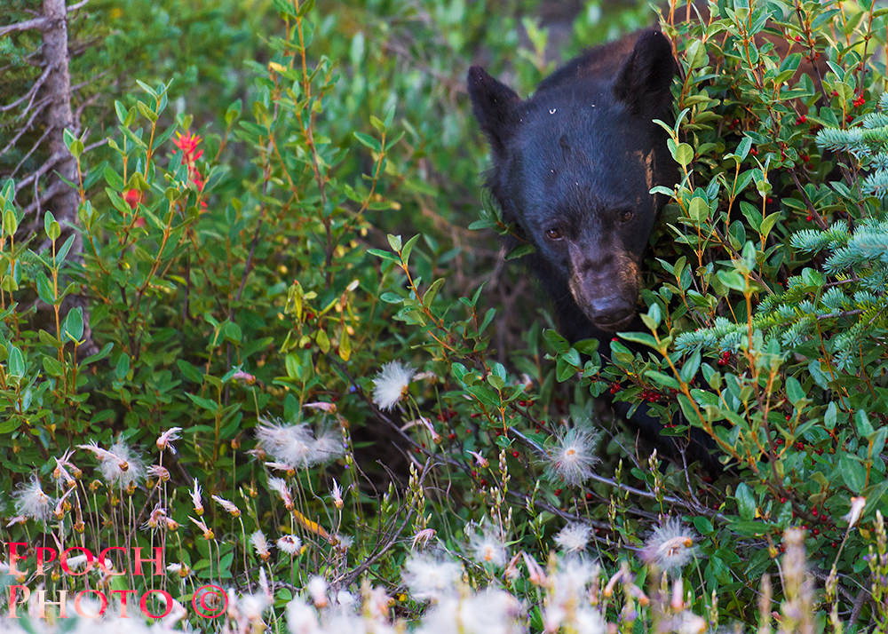
He didn’t seem to mind the crowds, however, as he was focused solely on devouring as many of the voluminous buffalo berries as he could find. Eventually, the bear decided that the buffalo berries might be sweeter somewhere else and bid the crowds farewell.
Banff Gondola To Sanson’s Peak On Sulfur Mountain
The Banff Gondola isn’t your average ski slope chair lift, but rather an engineering marvel that transports visitors approximately 2,300 feet in 8 minutes at an average angle of 51 degrees. Sanson’s Peak is named after Norman B. Sanson, who, over the course of his life, hiked from the city of Banff to the top of Sulfur Mountain over 1,000 times, chronicling information associated with weather, geology, insects, and plant life. From the top of Sanson’s Peak, we experienced an amazing view in every direction. It is perhaps the best view of the Canadian Rockies you can have, short of taking a helicopter ride.
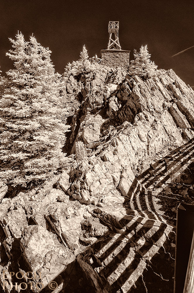
Sanson built a small hut, which doubled as a weather station, atop the rocky Sulfur Mountain and on eye level with many of the surrounding mountain peaks. Sanson’s work would prove invaluable to meteorologists, botanists, geologists, and others for many years, as it helped to identify changes to weather, flora, and fauna over time. To imagine that Sanson made this arduous trek so many times during the less-than-ideal conditions of his day, and without the advantages of modern day high tech hiking clothing and gear, is difficult to comprehend. But apparently it didn’t harm his health, as Sanson lived to the ripe old age of 87, spanning the years of 1862 to 1949.
Plain of Six Glaciers and Tea House – Lake Louise
Few scenes in the Banff/Canmore area are photographed more than the stunning blue-green water of Lake Louise and the Fairmont’s Chateau Lake Louise hotel.
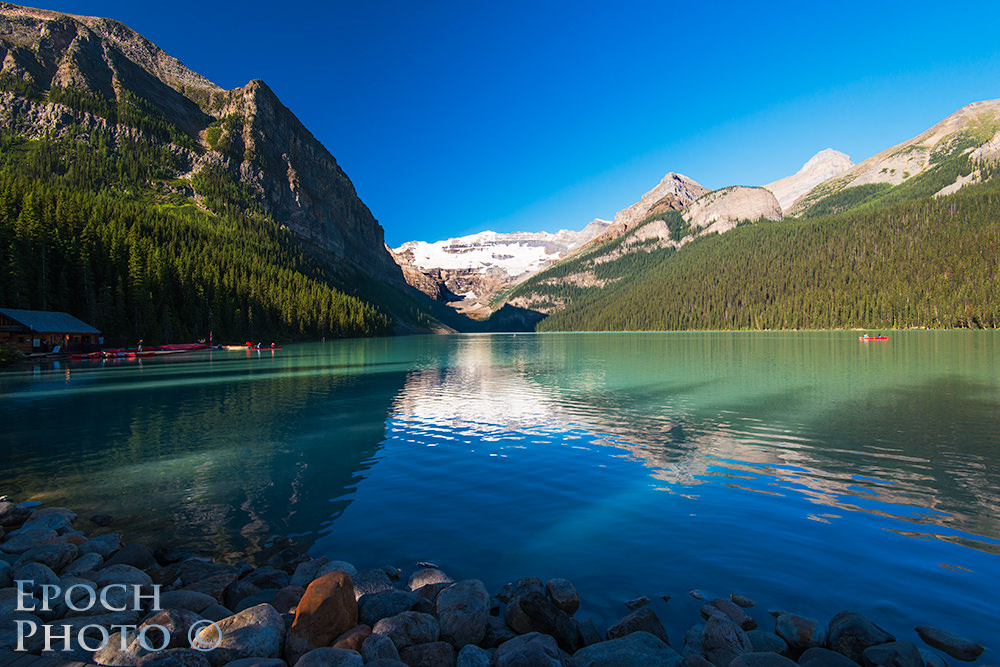
Prior to visiting this scenic wonder, I imagined that this blue-green water color was the result of someone going overboard in their color saturation settings in Photoshop. And yet the water of Lake Louise and other glacier fed lakes, rivers, and streams is indeed as colorful as depicted in most photos, due to the very mineral outlined earlier – rock flour.
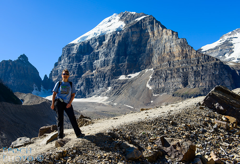
From the historic Chateau Lake Louise, you can view a few of the glaciers off in the distance. The Plain of Six Glaciers trail starts at the hotel, rises approximately 1,000 feet over a distance of 2 miles, and leads to a rustic log restaurant named, “The Tea House.” The trail is not very challenging during the initial portion, but can be quite steep in some areas, particularly if you are carrying a hefty backpack.
The Tea House is a welcome site after the very steep climb. The friendly staff serves a variety of home cooked meal and snacks, and of course, offers an exotic collection of teas. I have to admit that as we continued to navigate the steep trail, with my Lowepro 400 AWS Trekker backpack (review coming soon) filled with nearly 40lbs of equipment (as Tanya says of me, “Strong like bull, and half as smart!”), I began to doubt the existence of the Tea House, or the end of the trail for that matter! Once again I wondered if perhaps some grizzlies and wolves had placed the Tea House signs on the trail to make meals out of some unsuspecting hikers!
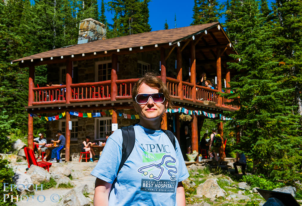
But we finally did spy the historic Tea House around a bend. The Tea House is a huge two story log cabin structure that exists to serve healthy meals and drinks to those hearty souls willing to make the long trek up the mountain. Despite the cool temperature, we were both soaked from sweat by to the time we arrived. I was wondering aloud why it was not a “Wine House,” which, at the time, seemed a bit more appropriate to me. I soon realized why hot tea made much more sense, however, since, once in the shade, I was reminded that evaporation is a cooling process. Within 15 minutes, I was reaching for my heavy duty, Eddie Bauer Polar Fleece jacket and wolfing down hot tea as quickly as the servers could bring it. I can’t honestly say that our lunch at the Tea House was objectively better than any other meal we had in the Canadian Rockies, but given how hungry and thirsty we were by the time of our arrival, the chips and hummus, tuna wrap, apple pie, biscuits and honey, and exotic tea certainly had our vote for the best meal of our trip! Over lunch, we were entertained by seeing huge portions of the glaciers sliding off the cliff faces as bright sun heated the mountain and accelerated the glacier’s slide. When the ice and snow broke off and landed a few a thousand or so feet below, it produced a sound much like thunder.
After relaxing at the Tea House for an hour, we discovered that there was another mile long trail, that led to an area relatively close to a huge cliff and edge of the Victoria Glacier we observed during lunch. We decided to work off some of our lunch by hiking up towards the glacier wall, but mistakenly took the horse path that led down and away from the glacier wall. Not wanting to miss the chance to get closer to the glacier, I made a decision to come straight up through, what appeared to be a relatively short and gently sloping hill along the lateral moraine. I turned out to be quite wrong relative to both the distance and steepness of the terrain. By the time we had reached the original path, we had likely burned off our delicious lunch, had navigated up some very difficult and treacherous terrain, and were breathing pretty heavily (note to self: Next time – stay on the trail!!!). Once again, I was reminded how easily we can be fooled, when, without the benefit of familiar objects being nearby, we make decisions regarding distance, the steepness of the terrain, and associated travel times.
Cascade Gardens And Bow Falls
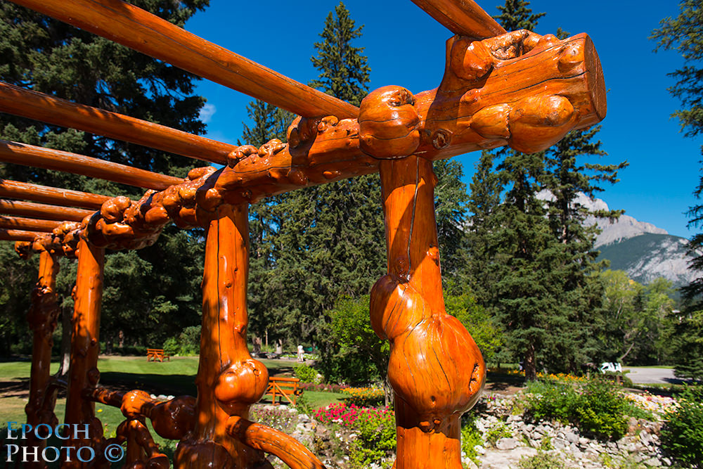
Prior to heading to back to Calgary for our flight home, we spent some time exploring the Cascade Gardens. Originally built during the Great Depression, the flower gardens offer a wide variety of plant life and unique trestles, benches, and gazebos. The Cascade Gardens are home to over 50,000 plants and well worth a visit. They are located toward the end of town just across the Bow River. We spoke with a carpenter that was recreating one of the trestles that had simply rotted with age. He took some time to explain the origin of what appeared to be enormous knots in the roughly hewed beams. Apparently, when this wood is infested with insects or some type of disease, it builds up a huge bulbous knot around the infestation/infection. This creates a very unique shape and sense of character.
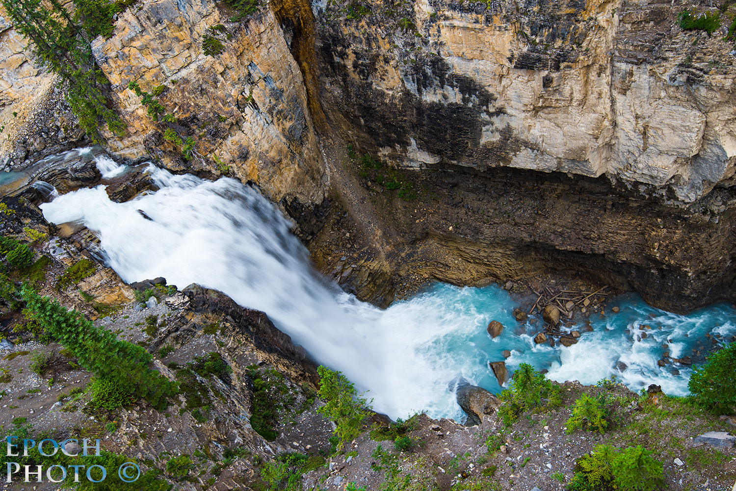
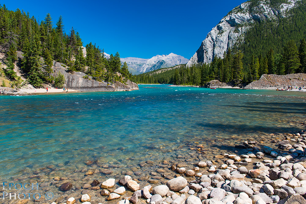
The Bow River flows through Banff toward the historic Fairmont Hotel at Banff Springs. Like other glacier fed bodies of water, the Bow River exhibits the same stunning display of bluish/turquoise colored water. 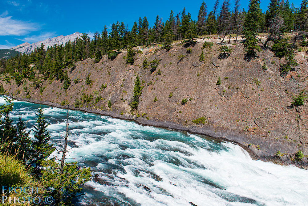
The path along the river eventually works its way behind the hotel. The change in elevation results the very tumultuous Bow River Falls which eventually spill into a calmer portion of the river where people launch boats and canoes.
Summary
If you are looking for an active vacation that offers incredible scenery, opportunities for hiking and backpacking, and the chance to take some spectacular photographs of wildlife, landscapes, and nature, I strongly recommend that you consider a trip to the Banff/Canmore area. It provides quite a bit of value for your travel/vacation dollars and as much “beauty per square mile (kilometer)” as you are likely to find anywhere in the world. The primary challenge you will face is choosing which of the many amazing attractions and sites to visit, and which to schedule for your next trip. We have been to many vacation sites and been able to say, “That was great, but I think we have seen just about everything we would want to see.” Given the nearly endless array of breathtaking locations to visit and accessibility to wildlife, however, we suspect we could visit the region quite a few times and still not feel that we have seen enough.
A few other suggestions for making your vacation to the area a success (and avoiding some trouble!):
• Renting a car? Make sure you request Sirius/XM Radio. It is usually a no-charge upgrade. You simply need to ask at the time of your rental if a car equipped with it is available. Trust me – it will come in handy when you are traveling in some of the more remote areas.
• Pack some winter clothing – at least some long pants and a fleece pullover for those cool mornings/nights, and a trip to the Columbia Icefields. Even in August, Banff/Canmore can get pretty cold when the sun goes down, particularly if it is windy.
• Make sure you have a polarizing filter for each of your lenses. I never took my polarizers off my lenses once I attached them. This region gets quite a bit of sun. The polarizers will help accentuate the already stunning colors you will encounter, and reduce the harshness of the mid-day sun.
• Bring your very best lenses, even if they weigh a bit more. Given the beauty of the area, you want to make sure you have every opportunity to get the best results.
• Memory cards – always have a view more than you think you need. Upon our return each day, I would go through and delete those photos that I realized were not going to make “the cut.” You will no doubt take more photos than you suspect, however, even if you are a careful shooter. A chance encounter with a wild animal alone may easily chew up 20-50 shots as you attempt to get that once in a lifetime shot.
• Camera batteries – always have 2-3 with you and bring your charger as well. And never trust your batteries. Always put them in your camera before the start of a journey and verify their charge levels.
• Bring a good, broken-in pair of hiking boots and few pairs of thick socks. Unless you are visiting the area solely for its cuisine, you will invariably find yourself on a nature or hiking trail. Good boots are a must, particularly if you venture out on some of the more challenging, remote trails. Twisting an ankle due to ill-fitting footwear, in some areas, may mean an expensive helicopter ride out. This can really put a damper on an otherwise great vacation.
• Arrange for an international calling plan (if you do not live in Canada) prior to trip. You can contact your cellphone provider and inquire. Verizon, by example, provided 100MB of data for $25 per month per device. Without such a plan, you may find your cellphone or iPad to be little more than an expansive paperweight. Cellphone coverage is pretty decent until you head up past Lake Louise.
• Have a comfortable backpack with some essentials. Given that bathroom facilities are sometimes rare, and you may find yourself in some harsh terrain, I recommend having the following items with you: small bottle of alcohol, hand sanitizing lotion, tissues/toilet paper/paper towels, band aids, bottled water, some trail mix or other snack, compass, decent sized foldout or hunting knife, bug spray, bottle of ibuprofen or naproxen, flashlight, lighter or waterproof matches, extra shirt or pullover if hiking in areas with widely fluctuating temperatures, extra pair of shoe laces (try hiking out of a difficult area without a shoelace sometime), a few maps of the area, and emergency contact information.
• Seriously consider purchasing what is commonly referred to as “bear spray.” We bought a can of bear spray (mace), just in case we encountered some grizzlies or wolves that mistook us for menu items. A can of bear spray can shoot a stream of potent irritant approximately 25 feet or so toward an attacking animal. While attacks are rare, you don’t want to find yourself face-to-face with a grizzly and have as your only protection, your digital camera. Although we never had to use our can of bear spray, it did bring some peace of mind. You want to make sure you are well-versed in its use, since if you need to rely on it in a real life scenario, you may have but seconds to correctly employ it. And the chances of bear or wolf stopping in order to give you time to learn the proper technique are pretty slim! :) We purchased our bear spray in Canmore, but later realized that the airlines enable you to carry it your checked-in luggage.
Equipment Used:
- Nikon D800
- Nikon 16-35mm f/4G VR
- Nikon 24-70mm f/2.8G
- Nikon 70-200mm f/2.8G VR II
- Nikon Circular Polarizer
- Marumi Circular Polarizer
- Hoya Circular Polarizer
- Nikon D90 – Converted for infrared use
- Nikon 16-85mm VR (permanently attached to the D90)
- Lowepro 400 AWS Trekker Backpack
- Benro C228 Carbon Fiber Tripod
- Benro KJ1 Ball Head
The vast majority of shots were taken with the Nikon 24-70mm f/2.8. Except for some tight quarters and the wild life shots, the 24-70mm f/2.8 could have been a good one lens solution. Next were those taken with the 70-200mm f/2.8 VR II. The 16-35mm f/4 VR was third most used. I had flashes, reflectors, teleconverters and two other lenses (Nikon 50mm 1.4G and Samyang 14mm 2.8), but they never came out of the bag. I relied quite a bit on my Lowepro 400 AWS Trekker. It proved to be a real workhorse. Despite how much I weighed it down (upwards of 45+lbs), it was as comfortable as could be to carry for long stretches up/down some very challenging terrain.
If you have any stories of the Banff/Canmore area, please feel free to share your experiences below. If you have any questions regarding a prospective trip to the area, drop me a line and I will try to help out in any way I can.
A Flickr member has posted one of your shots, claiming that it is his:
Hi Bob!
Great article, I thoroughly enjoyed it! I am heading out to Banff / Jasper in a few weeks and in the course of researching the trip, I ran across this. Your article provided some insights and included some wonderful images. I am traveling with my family and we will primarily hike and take photos. I’m interested in landscape and nature photography and would love to get some shots of the indigenous animals of the region. I’m struggling on determining the lenses to pack with me on my trip. I know I’m going to take my Nikon 18-35 3.5-4.5D IF-ED and my 70-200 VRII. I will also bring my D750 and D7100 cameras. I’ll likely throw in my 1.4ii teleconverter, polarizing filter and carbon tripod. I’ll be carrying all this in my Mindshift backpack.
I have the following on the shelf and could take: Nikon 300 f4, Nikon 24-120 f4, Tamron 150-600, Nikon 85 1.8g. I’d love to take either the 300 or the 150-600 too but they are heavy lenses and I can get really close to 300 mm if I mount the 1.4 teleconverter on my 70-200 VRII. The 150-600 would be great for the reach but I’m thinking it is just too big to haul. Do you think it would be worth bringing the 24-120 as well? Any other advice?
Thanks!!
Jerry
There seems to be a need for lens cleaning there is something that looks like © on everyone one of the very distracting
David,
Insightful comment. Thanks.
Bob
My favourite tale is not my own, but of a fellow who was a hang-gliding instructor who flew in the Rockies. He told me of thermalling up and underneath him was an eagle sharing the thermal. I think they avoided sharing the same airspace at the same time, but imagine what it would be in a setting like that to be looking down on an eagle soaring beneath you. It captured my imagination. (Perhaps I will have to take up the sport again when I retire, and if I can mount a good camera on the glider wow, the potential is just staggering.)
LOL, no I don’t work for them. I just really really love living in Alberta, and have lived all over the province, and you were in some of my favorite spots and I wanted to make sure if you ever come back, you don’t miss some of the other stupendous sights. I get to talking about it and obviously, I have a hard time stopping. If you have ever heard of Paul Brandt, he sings a song called Alberta Bound (easily found on YouTube) – it very aptly describes how I feel about where I live. Plus, it’s a great visual feast of Alberta (plus, I’ve been to many of the areas shown in the video).
If you ever do a Southern Alberta tour, you’ll have to go to Waterton Lakes National Park and west on Highway 3, through the Crowsnest Pass. That’s another favorite area of ours, that we want to explore some more. We don’t get down there nearly often enough, at least for me.
As for Colorado and Utah, I’ve never been there, but I have friends who do, and could put you in touch with them if they, and you, are willing. I’m sure they could tell you the best places to go and some out of the way spots that only the locals know about. I hope to one day get to both states. Actually, I’d love to get to a lot of states, haha.
Please come visit again – you won’t regret it. And, I can probably always give you some more spots to check out. ;)
AG,
You are obviously very passionate about the area. I liked the song and the scenery in it. Excellent! Thanks for sharing this one. I loved “Legends of the Fall,” but didn’t realize that it was filmed in Canmore until we visited the tourism office.
I figured I would ask about Colorado and Utah – just in case you were as knowledgeable regarding those areas! Actually, Nasim and Tom live in Denver, so they are pretty familiar with all the scenic areas in those parts. Tanya and I look forward to our next trip to Alberta. I suspect one could live there for a lifetime and never, ever tire of the area’s beauty.
Bob
Great photos! These are my stomping grounds so I’ve seen and/or hiked many of the areas you were in. We live east of Calgary, about 30 minutes, but we are out to the Canmore/Banff area several weekends a month.
For your next trip, might I suggest a few things? Stay at Baker Creek Chalets and use it as home base. We stay there a few times throughout the year, and the staff are amazing. The chalets are so wonderful to ‘come home’ to, after a long day. They will have some great hike suggestions and can point you in some directions you might not have thought about – they also generally know when trails are closed or open and same with different attractions in the area.
From there, hike Johnston Canyon. I would suggest going early, before the crowds arrive, if you’re there in the summer. It’s a wonderful hike in the winter too, though I’d suggest some strap-on ice cleats if you’re doing the hike in the winter. It’s very slippy-slidey. We haven’t hiked beyond the falls in the winter, but in the summer, after you’ve been to the falls, continue the hike up to the Ink Pots (some call them the Paint Pots).
From Baker Creek, it’s a short drive to Moraine Lake, which I didn’t see amongst your pictures. If you thought Lake Louise was beautiful, wait until you see Moraine. I think it’s even more beautiful than Lake Louise. It’s in the Valley of the Ten Peaks, and the view from the top of the rock pile, used to be on the back of our $20 bill. If you were at Lake Louise, you were basically at the road heading up to Moraine Lake – it’s right at the entrance to the parking lots at LL. The road is only open from the end of May through early October, after which it is closed for the season. You don’t really want to go up that direction until at least the end of June, early July – the ice is usually off the lake by then and the lake is at crest. If you’re headed up there, go early – by the time the summer months hit, it’s INSANE up there by noon, jam packed with tourists. If you can get up there for sunrise, I’d recommend it. Beautiful. There are multiple hikes throughout the ten peaks and while some are difficult, they are well worth doing – Sentinel Pass/Larch Valley (best done in September, so you can see the Larches turn gold), Consolation Lakes, Eiffel Lake/Wenkchemna Pass, Paradise Valley/Lake Annette – and a stroll along the lakeshore path is always nice. If you’re doing any of these hikes, check with Parks staff about the trails – it’s prime bear country and sometimes the trails are closed, or you’re only allowed to hike in groups of 4 or more, so you’ll want to try and latch onto another group of hikers, if there are only two of you – they do guided hikes as well, I believe.
From Baker Creek, you can head out to Yoho National Park, on Highway 1, which will take you into British Columbia. It’s not a long drive – if you leave early in the morning, you can pack in a full day of sightseeing and hit the major sights – no hiking, unless you have a place to stay overnight, as most of the hikes are long. We always stop at Spiral Tunnels ), just before Field, but a lot of people aren’t very interested in them. We love to wander around the village of Field as well, and there are several tiny eateries there that have very good food.
Around Field, you’ll want to drive up to Takkakaw Falls. You really don’t want to miss this. Like Moraine Lake, the road up to the falls is only open from June through October – for both Moraine and Takkakaw, you’ll want to either check with Parks staff or with the front desk wherever you’re staying, as to when the road is open – it really depends on how heavy the winter snowfalls were and the avalanche danger. Takkakaw Falls are at their zenith in July and must not be missed. MUST NOT. They are the second highest falls in Canada and you can hike right up to the base – easy easy hike. You can hear the booming of the falls before you even exit your vehicle. You can climb up the scree at the base of the falls, a ways as well – you definitely want to capture the crepuscular rays through the mist and also the rainbows. The closer you get to the falls, the cooler it gets and you’ll want to put a light jacket on. You’re also likely to get damp from the mist. There is a switchback a portion of the way up the road to Takkakaw, which is interesting and not to be done in an RV or with a trailer on – it’s even a tight turn for larger trucks and cars and you may have to give right of way for other vehicles coming down (or coming up, if you’re returning from the falls) – there are some smaller tourist vans that do trips up there, and they have it down to a fine science, getting through the switchbacks. Beauty trip, up and back. We’ve seen several moose along the way, on different trips there and back.
Just west of Field about 3 seconds, or so it seems, is the road up to Emerald Lake. A few minutes drive up the road, and there is a spot you also need to stop at – The Natural Bridge. Stunning. Continue on up and you’ll soon reach the parking lot at the lake – be sure to follow the road right to the lake. Emerald Lake Lodge has a parking lot a little ways down the road from the tourist parking lot, and you don’t want that one – that’s where you leave your vehicle if you’re staying at the lodge, and hop on their shuttle bus. The shuttle bus is practically the only vehicle aside from the odd maintenance truck, that is allowed to cross the bridge over to the lodge. So be sure to follow the road right to the end. There is a beautiful hike (stroll, really) along the lake shore and you can also rent canoes for a glide on the lake. Definitely worth a stop.
Those are the highlights of that area, if you aren’t planning on doing any of the numerous hikes in the area, and an easy day trip from Baker Creek. There are other places worth seeing but most involve some long hikes, and if you’re just doing a day trip, Takkakaw, Emerald Lake, the Natural Bridge and Field is a full day’s worth, especially if you love photography because you’ll want to stop every 3 feet to take pictures, LOL.
Also an easy trip from Baker Creek, is Highway 93 out to Radium Hot Springs – also known as the Banff-Windermere Parkway and/or the Kootenay Highway. That highway is chock full of animals, so have your camera always at the ready – our last trip through there we saw 2 grizzlies, 7 black bear (sows & cubs), 5 or 6 moose, several mountain goats, plenty of deer and elk and right in Radium, you will generally see the town herd of Bighorns. Several nice little stops along the way – Storm Mountain Lodge & Storm Mountain, the Continental Divide marker is fun – our kids like to stop there and ‘hop’ back and forth between Alberta and BC at the marker. There are several good hikes along the way as well – Marble Canyon, Stanley Glacier – oh heck, there are too many to mention. Coming down into Radium through the red rock cliffs is awesome. Make sure you have your camera at the ready as you begin the descent into town. Definitely stop for a soak in the hot pool. Well worth it.
If you want to do the loop, from Banff through Radium and back, I recommend checking for highway conditions, even in the summer, due to rock slides and/or accidents. Last summer, we had to do the loop through Golden and then out to Radium, instead of from the Highway 93 turnoff, along the Kootenay higway, because of a major accident just outside of Radium. 4 hours after we left the Field area, the road was closed due to a major rockfall. So be aware of the highway conditions, even though these are major highways.
We like to go from Banff up to Highway 93 and out to Radium and stay in Radium at least 2 nights. If you’re going to Radium, stop and stay at The Bighorn Motel with Bill & Angela, and tell them Bill & Cindy sent you. *wink* Older motel, but good for the budget but clean as a whistle, and comfortable and Bill & Angela are the best hosts you can have. From here, you can do day trips to Invermere & up to Panorama (beautiful drive), Fairmont Hot Springs, etc – lots of easy day trips in the area. We aren’t so fond of the Fairmont Hot Springs at the resort – we call it ‘people soup’ – too small. Radium is better. If you’re eating in the area, Back Country Jack’s in Radium has good eating. Watch for all you can eat rib night. Lots of good restaurants in Radium. For breakfast though, we drive the few miles into Invermere and eat at Huckleberry’s – can’t beat their breakfasts. Inveremere is right on the lake, and has many lovely and quaint shops to explore. As mentioned, the drive from here up to Panorama Ski area is a beautiful one.
We then come back through Golden, and Field, on Highway 1 and check out Takkakaw and Lake Emerald and so on, even though we’ve been to each of these many many times.
You really must come back to us for another visit, and soon. Great blog and photographs, by the way.
Dear AG,
Wow! That was one heck of a response – almost longer than my article! :) Your reply encompasses an entire vacation plan – for our next trip. Do you work for the Alberta Tourism Department? :) I very much appreciate your taking the time to respond so thoroughly. As I indicated, it was tough to get to every place we wanted to visit, particularly since Tanya and I were finding our way around a bit and allowing some time for diversions and a bit of down time. Some of the places you mentioned were on our list, but we didn’t want to rush things, choosing to meander a bit and get off schedule, even if it meant that we saw less of the area.
We suspected that once we had been there and gotten to know the area fairly well, we might be better able to budget our time, while including some trips and eliminating others. We will likely figure where we wish to go for our next adventure. It is tempting to head back to Banff. We are also looking at a trip to Colorado and Utah as well. Any advice for these states? :)
Bob
Have you heard if Nikon has fixed the problem with their d800e autofocus problem? I want to buy one but do not want to go through the hassle of dealing with an autofocus problem so I want to wait until the problem is resolved. Do you have any update as to problems with the d800e that they are now shipping to consumers?
Thank you for any advice
jack mitchell
Magnificent Bob!
Samer,
Thanks. The Marumi seems to do a very good job compared to others and is very reasonably priced. I didn’t perform a head-to-head test between it and my Hoya and Nikon CP, but I can’t tell any difference in the photos. www.lenstip.com/115.4…mmary.html
Bob
Hi Bob,
Nice article and great pictures..
How would you rate the Marumi Circular Polarizer seeing that you have first hand experience with it. It costs half the price of the infamous B+W Kaesemann for a 77mm one, but really how does it compare.
Cheers and thanks..
samer